

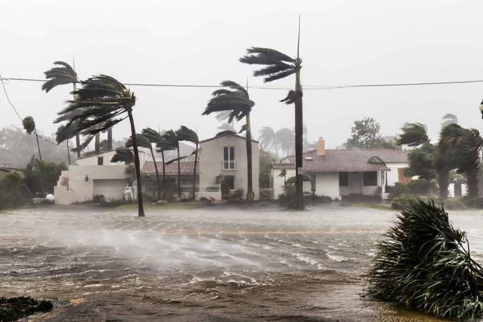
Tropical Storm Bertha tested New Orleans with a serious threat, then swerved just enough to turn a citywide alarm into a close call.
Story Snapshot
- National Hurricane Center forecasts clearly warned Metro New Orleans of tropical storm conditions.
- Bertha made landfall in St. Bernard Parish, southeast of New Orleans, with dangerous rain, wind, and surge.
- Heaviest wind and rain stayed mainly south and east of the city, but coastal Louisiana still saw flooding risk.
- The storm showed how forecast uncertainty and media headlines can clash with local reality.
Tropical Storm Bertha Targets The Louisiana Coast
Forecasters warned early in the week that Tropical Storm Bertha would bring heavy rain, strong winds, and coastal flooding from the Florida Panhandle west into Louisiana. The storm formed south of the Florida Panhandle and moved slowly toward the central Gulf Coast, gathering enough strength to earn tropical storm status with sustained winds around 40 to 50 miles per hour. A swath of the northern Gulf Coast went under tropical storm warnings, including coastal Louisiana and the Metro New Orleans area, as Bertha edged closer to landfall.
National Hurricane Center forecasters made it plain that tropical storm conditions would spread westward along the northern Gulf Coast, including New Orleans, as Bertha approached. One forecast discussion stated that tropical storm conditions were expected from Mississippi to southwestern Louisiana, “including the Metro New Orleans area,” through the night and into Thursday. Those conditions meant sustained winds near or above 39 miles per hour, rough surf, dangerous rip currents, and bands of heavy rain capable of flash flooding.
Landfall In St. Bernard Parish And The Storm’s Core Impacts
On Wednesday, Bertha finally made landfall along the marshy coast of southeastern Louisiana. The center came ashore in St. Bernard Parish, near the Biloxi Wildlife Management Area, roughly 40 miles east of downtown New Orleans. By landfall, maximum sustained winds had eased to around 45 miles per hour, but forecasters still warned of coastal flooding and gusts near tropical storm strength. Rain totals of one to four inches were expected, with higher amounts possible in isolated spots along the Gulf Coast.
Live coverage and local forecasts stressed that the worst impacts would hug the coast rather than slam inland cities. Some Louisiana outlets emphasized that Bertha looked “messy and lopsided,” with its strongest winds and heaviest rain displaced to the south side of the circulation over Gulf waters. That lopsided structure kept the most dangerous conditions closer to barrier islands, marshes, and the open coastline, yet did not erase the threat of flash flooding in low-lying and urban areas where downpours lined up over the same streets.
How New Orleans Stayed On Edge But Avoided The Worst
Metro New Orleans spent much of Tuesday and Wednesday under a tropical storm warning or watch, depending on the hour, as guidance shifted and the center wobbled along the coast. City briefings relayed National Weather Service expectations that tropical storm conditions, with frequent gusts between 39 and 57 miles per hour, were possible across the metropolitan area as Bertha moved near or along the southeast Louisiana coast. Residents saw rough lakefront waves, squalls, and periods of heavy rain, but inland impacts stayed more limited than early headlines suggested.
Several forecasts highlighted that Bertha’s strongest weather would likely stay south and southwest of New Orleans. A USA Today summary based on local weather service input noted that strong winds over the Gulf were likely to weaken the storm and “keep the heaviest rain well to the south and southwest of the New Orleans region.” From a common-sense conservative view, that is exactly why broad regional warnings exist: you safeguard people where the risk is real, even if a specific city ends up with a near miss rather than a direct hit.
Warnings, Media Framing, And The Forecast Uncertainty Gap
Bertha’s run along the Gulf Coast fits a familiar pattern in modern storm coverage. The National Hurricane Center and local National Weather Service offices issue careful, region-wide guidance that reflects real uncertainty about the exact track and intensity. New Orleans, coastal Mississippi, and parts of Alabama all faced possible tropical storm conditions, so they were rightly placed under warnings and watches. Media outlets then compress that wide threat zone into sharper city-focused lines, like “Bertha targets New Orleans,” which can overstate what any one metro will actually feel.
2 AM Bottom-of-the-Hour News
Tropical Storm Bertha continues moving over southern Louisiana toward Texas after making landfall earlier in St. Bernard Parish, about 40 miles east of New Orleans.
At landfall, Bertha had maximum sustained winds of around 45 miles per hour, and is… pic.twitter.com/FwGuFeDnFX— Worldwide News Network (@WorldwideNNX) July 23, 2026
Forecast research shows why that gap exists. A study of Gulf storms between 1979 and 2008 found that tropical storms and depressions typically strengthen by about seven knots every twelve hours over open Gulf waters, yet often show little net change in the final twelve hours before landfall. That means Bertha had room to wobble in strength and structure, but not to suddenly explode. For a storm as lopsided as Bertha, small shifts in the center track made the difference between pounding New Orleans or hammering mostly offshore and coastal zones instead.
Why Trustworthy Forecast Sources Matter In Storm Season
This storm also underscored the growing problem of social media hype. The National Hurricane Center has recently warned that false or exaggerated online headlines can be “very dangerous,” because they either scare people into tuning out or lull them into ignoring real threats. For Bertha, official sources called for heavy rain, tropical storm force gusts, coastal flooding, and rip currents from Florida through Louisiana. Those advisories matched what people along the coast actually saw, even though downtown New Orleans dodged the worst bands.
From a conservative values standpoint, the lesson is simple and practical. Personal responsibility starts with knowing whom to trust. When the National Hurricane Center says tropical storm conditions are expected “including the Metro New Orleans area,” that is not fearmongering. That is a sober call to prepare for what might hit your neighborhood, not just the exact spot where the eye crosses the shoreline. Bertha gave New Orleans a scare and spared it a beating, but for the rest of the Gulf Coast, the storm was no mere headline.
Sources:
local10.com, nhc.noaa.gov, weather.gov, accuweather.com, youtube.com, wbrz.com, rammb2.cira.colostate.edu